E-commerce Search Demo
AI Assisted Filters
Parameters
Query:
Category filters: All
AI Assist: ON
Page: 1
Products
Time taken: 3 Max score: 1000.000 Total hits: 100 Full time: 0.0 s
Showing 1-10 of 100 products
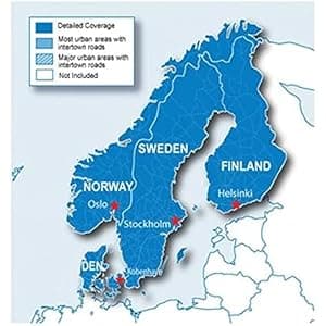 B00XIQKXQE Price: $72.75 Score: 1000.000 Category: Electronics Rating: 4 Votes: 82 Find similar productsGarmin City Navigator Nordics for Detailed Maps of Denmark, Finland, Norway, and Sweden (microSD/SD Card). Everything you need to travel the Nordic countries is included in these highly detailed street maps. Load City Navigator Europe NT Nordics directly to your device and navigate turn by turn to any address or intersection. Route to points of interest including restaurants, petrol stations, lodging, attractions and more. Coverage includes detailed maps of Denmark, Finland, Iceland, Norway and Sweden. Powered by NAVTEQ, a world leader in premium-quality digital map data. |  B000WJ67UQ Availability: Currently unavailable Score: 7.937 Category: Electronics Rating: 3.7 Votes: 292 Find similar productsGarmin City Navigator Europe NT - Benelux/France. microSD/SD memory card, City Navigator NT, BeNeLux & France. Contains full detailed coverage of Belgium, the Netherlands, Luxembourg and all of France. |
 B001OI2ZA0 Availability: Currently unavailable Score: 7.634 Category: Electronics Rating: 1 Votes: 1 Find similar productsGarmin GB Discoverer 2010 Pennine Way Topographical Map microSD Card. Explore Great Britain's national parks and trails with detailed topographic and road maps. Garmin GB Discoverer National Parks & Trails contains topographic maps from Ordnance Survey of Great Britain including OS Explorer Map as detailed as 1:25,000 scale and 1:50,000 scale Landranger maps for one region of the country. With NAVTEQ road data and points of interest for all of Great Britain, you'll get turn-by-turn directions to your destination. GB Discoverer's detailed topographic data includes terrain contours, topo elevations, summits, paths, routable roads and geographical points. The premium NAVTEQ road data is the same detailed data included in our leading automotive products — with thousands of addresses and points of interest, including lodging, food and drink, car parks, banks, petrol stations, attractions, campsites, and more. Search for an address or point of interest, and your Garmin device displays turn-by-turn directions to your destination. |  B00XJCJBTC Price: $147.95 Score: 6.410 Category: Electronics Rating: 4.2 Votes: 34 Find similar productsGarmin BlueChart g2 Canada Salt/Freshwater Map microSD Card. See your surroundings more clearly with BlueChart g2 data. With BlueChart g2, you'll get detailed marine cartography that provides convenient viewing of nautical content. BlueChart g2 allows you to see your vessel's precise, on-chart position in relation to naviads, coastal features, anchorages, obstructions, waterways, restricted areas and more. You will also have access to detailed mapping capabilities that include Safety Shading, Fishing Charts, smooth data transition between zoom levels, harmonious transition across chart borders, and reduction of chart discontinuities. |
 B00P0DM26M Availability: Currently unavailable Score: 6.250 Category: Electronics Rating: 5 Votes: 1 Find similar productsGarmin Us Lakevu Hd Microsd/Sd Charts For Gpsmap, Oregon, And Product Category: Cartography - Garmin/Inland Lakes. GARMIN US LAKEVU HD MICROSD/SD CHARTS FOR GPSMAP, OREGON, AND - LakeVü™ HD - microSD™/SD™ - With maps of more than 17,000 U.S. lakes - many with 1' contours throughout - this HD-mapping product brings new levels of detail to your chartplotter. - Features - Contains more than 400 HD lakes with 1' contours throughout to help you pinpoint the best places to find fish - Displays points of interests, including docks, designated fishing areas, campgrounds, boat ramps, marinas and bridges - Shows interstates, highways and general roads - Shows underwater features, such as riverbeds, bridges, roads, fish attractors and potential hazards - Offers Safety Shading, which lets you input and shade a minimum depth to help you avoid running aground Coverage: - Features detailed coverage of more than 17,000 freshwater lakes, resevoirs and rivers throughout the continental U.S. - Compatible Devices - GPSMAP® Series - Montana® 6xx Series - Oregon® 6xx Series -. |  B001B8N6CO Availability: Currently unavailable Score: 6.211 Category: Electronics Rating: 3.5 Votes: 122 Find similar productsGarmin City Navigator North America for Detailed Maps of the United State, Canada and Mexico (DVD). Product Description With nearly 6 million points of interest and road coverage for the U.S., Canada and Puerto Rico, City Navigator North America NT gives you everything you need to travel North America. Powered by NAVTEQ, a world leader in premium-quality digital map data, City Navigator brings you the most detailed street maps available so you can navigate with exact, turn-by-turn directions to any address or intersection. Amazon.com Thanks to the Garmin MapSource City Navigator North America NT Version 8, which gives you access to all the data you need to navigate North America, you may never have to ask for directions again. This software automatically creates point-to-point routes in MapSource and on your NT compatible Global Positioning System (GPS), and includes detailed, premium street maps of North America, plus a hefty points of interest database at your fingertips. Featuring full coverage of the United States, Canada, and Puerto Rico, including metropolitan and rural areas, the Garmin MapSource City Navigator North America NT Version 8 makes it a snap to travel to a new city, look up your hotel, restaurants, and other services, and then use your compatible Garmin GPS to guide you there. For added convenience, you'll be able to take advantage of detailed maps containing highways, interstates, business and residential roads with attributes such as turn restrictions, roundabout guidance, speed categories and other navigation features. Ideal for vacation-planning, the Garmin MapSource City Navigator North America NT Version 8 also displays nearly six million points of interest, such as postal offices, attractions, shopping, and emergency services. The Garmin MapSource City Navigator North America NT Version 8 and data cards include the same detailed maps, points of interest and coverage areas as the traditional City Navigator North America data, just compressed differently for your NT compatible unit. The Garmin MapSource City Navigator North America NT Version 8 is designed for use with StreetPilot 2720, 2730, 2820, 7200, 7500 and the StreetPilot C-Series. It's also compatible with the StreetPilot i-Series, iQue 3000, M3, M4, Quest 2 and various handhelds such as GPSMAP 60Cx/60CSx/76Cx/76CSx and eTrex Legend Cx/Vista Cx. |
 B00283PP4I Availability: Currently unavailable Score: 6.098 Category: Electronics Rating: 3.7 Votes: 4 Find similar productsGarmin BlueChart g2 - HUS041R - US West Data Card February 2014 Revision (35808). BlueChart g2 - HUS041R - US West - Garmin Data Card Provides detailed coverage of the North American west coast from the North Slope of Alaska to the U.S. - Mexican border including the Hawaiian Islands. Coverage features the Aleutian and Channel Islands, the Inside and Outside Passages, Puget Sound, San Francisco Bay, and San Diego Bay. Detailed coverage also includes the Columbia R. to its juntion with the Snake R., and the Snake R. to Lewiston, ID. Features: Includes realistic navigation features showing everything from shaded depth contours and coastlines to spot soundings, navaids, port plans, wrecks, obstructions, intertidal zones, restricted areas, IALA symbols and more Features smooth displays, including seamless transitions between zoom levels and more continuity across chart boundaries Allows users to choose between standard 2-D direct overhead or 3-D over the bow map perspective to make chart reading and orientation easier Provides Safety Shading (in compatible units), allowing mariners to enable contour shading for all depth contours shallower than user-defined safe depths Provides Fishing Charts (in compatible units), allowing mariners to scope out bottom contours and depth soundings with less visual clutter on the display Allows users to conveniently plan and organize routes, from your computer, before your trip with HomePortT, compatible trip-planning software (sold separately). |  B00FMUYYZA Availability: Currently unavailable Score: 5.917 Category: Electronics Rating: 3.8 Votes: 249 Find similar productsGarmin nüvi 2798LMT Portable GPS with Backup Camera. Advanced Series Navigation with Backup Camera 7.0 display 7.0 display Comes with BC™ 20 wireless backup camera Comes with BC™ 20 wireless backup camera Detailed maps of North America with free lifetime map¹ and traffic² updates Detailed maps of North America with free lifetime map¹ and traffic² updates Garmin Real Directions™ with Garmin Real Voice™ Garmin Real Directions™ with Garmin Real Voice™ Voice-activated navigation, Bluetooth® and Smartphone Link compatible Voice-activated navigation, Bluetooth® and Smartphone Link compatible Detailed Maps with Free Updates nüvi 2798LMT arrives with a bright 7.0 display and loaded with detailed maps of North America. With free lifetime¹ map updates, your routes are sure to reflect the most up-to-date maps available, points of interest (POIs) and navigation information. New maps are available for download with no fees. With so much data, nüvi 2798LMT makes it easy to find addresses and millions of POIs such as businesses, stores, restaurants and other destinations. nüvi 2798LMT arrives preloaded with POIs, so there’s no need for you to enter that address information. Just select one — or many — and navigate there, quickly and easily. You also have the ability to add custom POIs to your nüvi 2798LMT. Wireless Backup Camera Included nüvi 2798LMT comes bundled with the BC 20 wireless backup camera. Easily spot vehicles, pedestrians and other obstructions right on your screen as you back up your vehicle. The transmitter will send camera footage to nüvi 2798LMT from up to 45 ft (13.7 m) away. Professional installation recommended. Garmin Traffic nüvi 2798LMT features Garmin Traffic to help you spend more time on the move. With Garmin Traffic, your driving map remains onscreen at all times. Traffic alerts appear to the side of your map and messages are spoken, too. Garmin Traffic can give details about the situation, such as how many minutes of delay to expect and if there are any possible detours. It can even confirm whether or not you are on the fastest route. Garmin Traffic is voice activated, so it responds to spoken requests. Lifetime traffic² entitles your nüvi 2798LMT to receive free traffic information for its entire useful life. The Power of Your Voice nüvi 2798LMT has the luxury of voice-activated navigation. Speak, and your device intelligently responds; your hands can remain safely on the wheel. Of course, you can also navigate using the touchscreen interface. Make Hands-free Calls Sync a Bluetooth-enabled device, such as your smartphone, to nüvi 2798LMT for hands-free calling through its integrated microphone and speaker. Stow your phone in a glove compartment, pocket or purse and still make and take calls without moving your hands from the steering wheel or your eyes from the road. Smartphone Link Compatible Smartphone Link³ is a free mobile app that connects your nüvi 2798LMT with your iPhone® or Android™ smartphone. When paired, your nüvi 2798LMT can use your phone’s existing data plan to share information — such as where you parked, POIs and your destination. Smartphone Link also gives you access to Garmin Live Services⁴, useful real-time information such as weather and traffic conditions. Garmin Live Services are available free and by subscription. Garmin Real Directions with Garmin Real Voice nüvi 2798LMT redefines “spoken turn-by-turn directions” with Garmin Real Directions, easy-to-understand driving directions that guide like a friend, using recognizable landmarks, buildings and traffic lights. No more stress from trying to read street names. Garmin Real Voice is refined speech technology that sounds more like a natural, friendly voice. Garmin Real Directions and Garmin Real Voice are features that are only available in our line of GPS navigators. Comprehensive Driving Guidance You See and Hear Active Lane Guidance with voice prompts prepares you to drive through an exit or interchange with confidence. As you approach, an animated model uses brightly colored arrows to indicate the proper lane needed for your route; a friendly voice offers additional help. Bird’s Eye junction view offers a detailed view of interchanges, looking down as if from overhead. photoReal junction view realistically displays junctions and interchanges along your route, including the surrounding landscape. Brightly colored arrows indicate the proper lane to drive. nüvi 2798LMT also depicts real road signs as they appear along your route. More Information at a Glance nüvi 2798LMT keeps your driving map onscreen at all times and additional information appears alongside. For details, simply ask or touch the screen. As you drive your route, Up Ahead constantly informs you of nearby services, including restaurants, fuel stations, hospitals and stores. nüvi 2798LMT displays speed limit, current speed and accurate time of arrival. With a quick glance, you can read the name of your current street. nüvi 2798LMT also shows school zone warnings. One-stop Device Management Use Garmin Express to keep your nüvi up-to-date. Garmin Express makes it easy to update maps and software, transfer favorites to and from devices, and install free custom vehicles and voices. ¹Lifetime Maps Terms & Conditions can be found at http://www.garmin.com/en-US/legal/lmdisclaimer ²Lifetime Traffic Terms & Conditions can be found at http://www.garmin.com/en-US/legal/ltdisclaimer ³User’s data plan charges, if any, will apply. Contact your mobile service provider for more information about your service plan’s data and roaming rates. ⁴Subscription may be required. Android is a trademark of Google Inc. iPhone and App Store are trademarks of Apple Inc. |
 B00400CELE Price: $99.99 Score: 5.917 Category: Electronics Rating: 4.2 Votes: 132 Find similar productsGarmin Bluechart G2 - HXUS039R - Us G2 (Entire Us) - MicroSD and SD. This chart is NOT compatible with GPSMAP 722sx, 7612xsv, 7610xsv, 922xs, Echomap Plus series or units with the latest update software/firmware. Provides detailed coastal coverage of the U.S. including the East Coast from Key West, FL to Canadian border and the West Coast from Puget Sound to the Mexican border; Alaska; Hawaii and major inland rivers; the U.S. Gulf Coast to the Mexican border and the Mexican Gulf Coast thru to the Yucatan. Canadian coverage includes the entire St. Lawrence Seaway, Nova Scotia, and New Brunswick. The Great Lakes are covered in their entirety as are the Lake of the Woods. Coverage includes Prince Edward Island, Anticosti Island, Vancouver Island including the Inside and Outside Passages, the Aleutian and Channel Islands, the Bahamas, the Turks and Caicos Islands, Cozumel, Cuba, Hispaniola, Puerto Rico and the U.S. Virgin Islands. |  B005HSDL92 Availability: Currently unavailable Score: 5.714 Category: Electronics Rating: 3.2 Votes: 29 Find similar productsGarmin nüvi 40 4.3-inch Portable GPS Navigator(US and Canada). nüvi 40 delivers you safely wherever life takes you. Designed to make navigation easy, simply enter an address and premium features including lane assist with junction view, help you make all the right turns!Start out for your destination and leave the navigating to nüvi 40. This device features a 4.3” (10.92 cm) touchscreen and provides accurate, turn-by-turn directions that speak street names. Get Turn-by-Turn Directions nüvi 40's intuitive interface greets you with two simple choices: Where To? and View Map. Touch the screen to easily look up addresses and services and to be guided to your destination with voice-prompted, turn-by-turn directions that speak street names. It comes preloaded with maps for the 49 States and Canada. nüvi 40’s speed limit indicator shows you how fast you can go on most major roads. With its Where Am I? emergency locator, you always know your location. It also comes preloaded with more than 8 million points of interest (POIs) and offers the ability to add your own. Know the Lane Before It’s Too Late Now there’s no more guessing which lane you need to be in to make an upcoming turn. Available in select metropolitan areas, lane assist with junction view guides you to the correct lane for an approaching turn or exit, making unfamiliar intersections and exits easy to navigate. It realistically displays road signs and junctions on your route along with arrows that indicate the proper lane for navigation. What's in the Box nüvi 40, preloaded NAVTEQ North Amercan maps, vehicle suction cup mount, vehicle power cable, and quick start manual Compare all Garmin nü vis Click the button below to compare by series, user type, and features. All nüvis come with detailed NAVTEQ maps containing more than 6 million pre-loaded point of interest locations. |